We started from the Eaton Canyon Natural Area County Park parking lot at 960
feet above sea level, and walked 10.1 miles to the top of Mount Wilson at 5,710
feet above sea level (a increase in elevation of 4,750 feet). We followed the
Mount Wilson Toll Road for the bulk of our trip, and only stopped a couple of
times for snack bars and drinks, though I dallied a bit more taking pictures
along the way.
Below are a few of Andrey's log entries from our trip:
9:22 AM -- departing from Eaton Canyon parking lot
9:47 AM -- we are at the top of Horse Trail
10:35 AM -- arrive at Henninger Flats
10:45 AM -- leaving Henninger
12:45 PM -- we are at the "alien launch pad" (that looked like water collection
structure)
12:55 PM -- we are at the bottom of "Mt. Probe" (which turned out to be Mt.
Harvard)
13:05 PM -- arriving at Sierra Madre fork (the narrow path that goes down to
Sierra Madre)
13:47 PM -- arriving at the final destination -- Mt. Wilson parking lot
And now for the photos...
 |
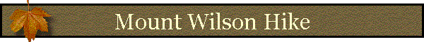
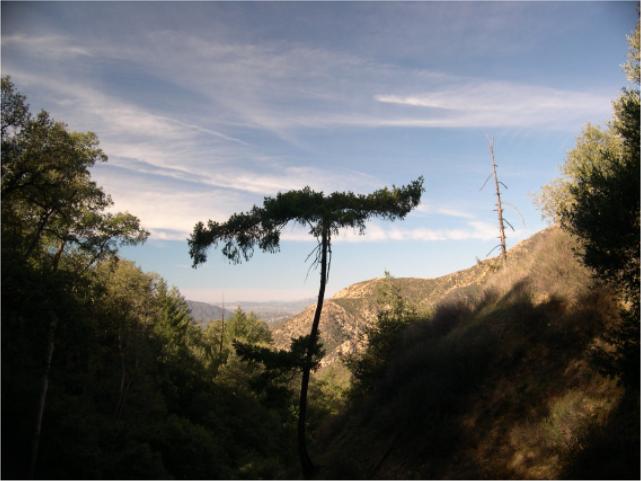
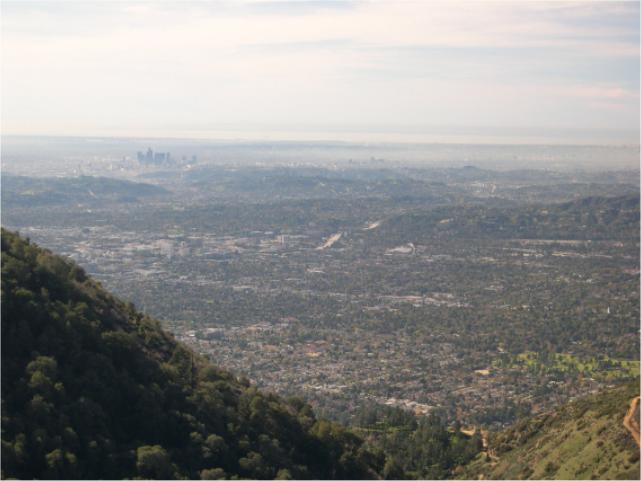
I want to give you a visual idea of how high up we climbed.
So I'll start you off with this picture from a point about 15 minutes into
our hike. We've just climbed above the opposite wall of Eaton Canyon so you
can look out above the horizon and see Los Angeles sticking up in the
distance. |
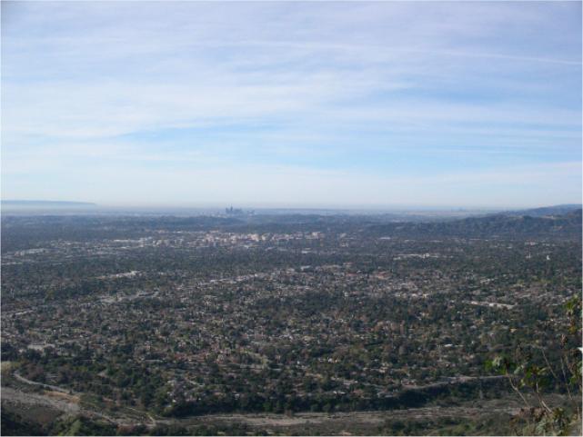 |
Whew...we're really just getting started still, yet you can
see how high we've come in just a little while. This is a point maybe a half
hour up. |
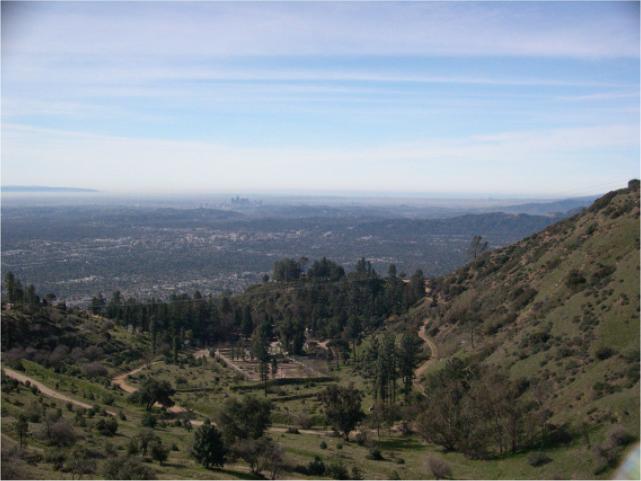 |
Well, you can see we're getting higher still. This is taken
just above Henninger Flats (about 3.7 miles into the 10.1 total miles). You
can see the remnants of the (largely unused now) agricultural test beds near
the ranger station. |
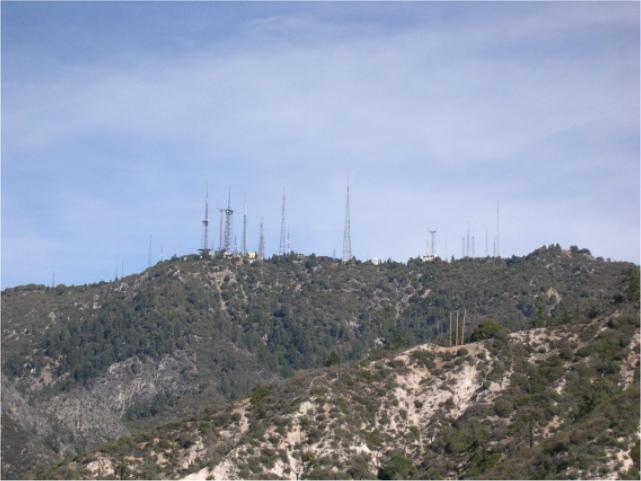 |
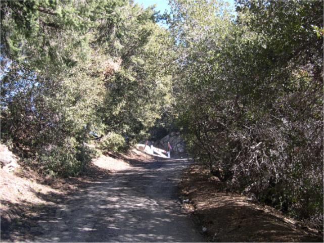
We rounded a bend, and this was the first full view of our
target...the evil spires of Mount Doom, errr...I mean Mount Wilson. |
 |
Gorgeous, isn't it? Once above Henninger Flats the climb was
much more pleasant. Both the view was nicer as were the immediate
surroundings. Many trees and shady spots, I liked this part of the hike the
best. |
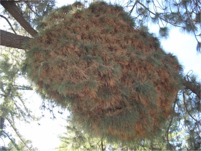 |
Andrey pointed out this odd growth on this pine tree. The
bundle you're looking at is perhaps six feet across. What do you think it
is? I've never seen anything like it before. |
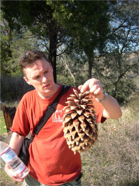 |
At the higher elevations there are pine trees that grow some
LARGE pinecones. Andrey gingerly picks up one sap-soaked specimen and gives
it a heft. |
 |
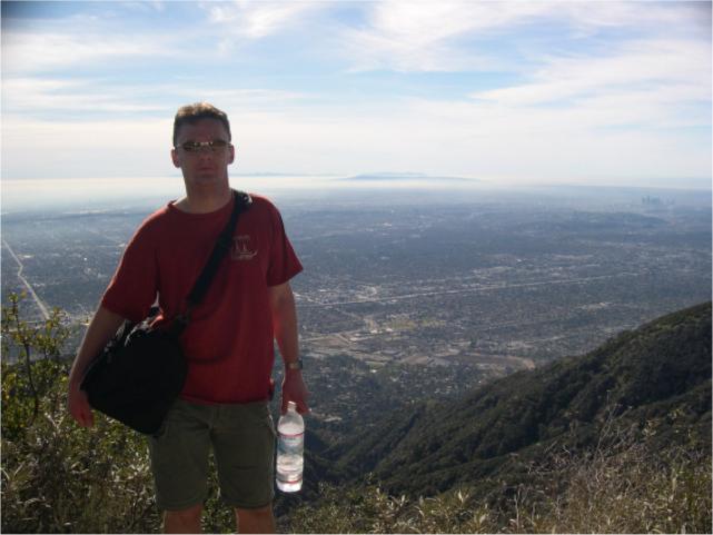
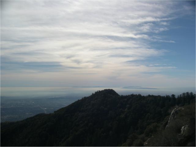
Getting higher still... Can you see the ocean? In one of
the photos at the end you'll see that it becomes even clearer, though the
haze picked up a bit more in the afternoon hours. |
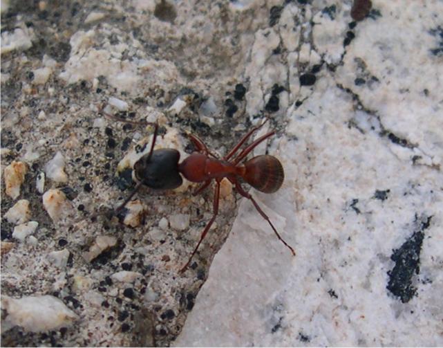 |
This fuzzy-butted fellow was lingering on a rock as Andrey
and I took a short breather. If you look carefully you can see the little
hairs covering his backside. He was about one-eighth inch long. |
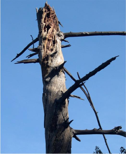 |
See how the woodpeckers have been working this old tree
over? |
 |
Our target looms nearer. The sky was spectacular. |
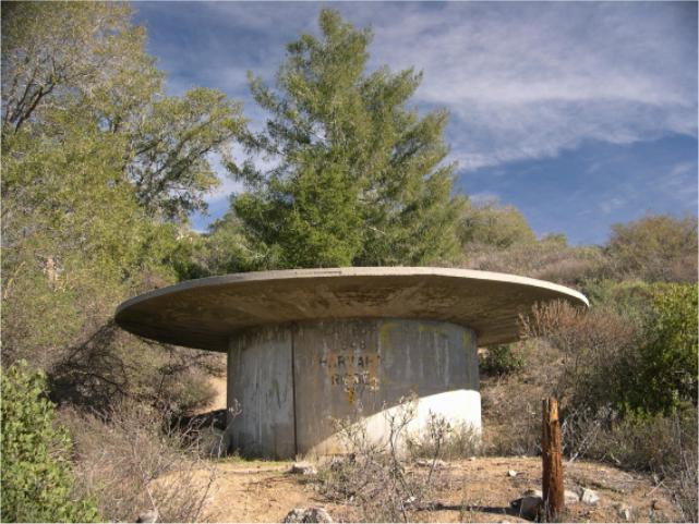 |
We rounded a corner and found an alien launch pad. It seems
the government has been keeping this secret for years, but explorers like us
couldn't be deterred from the arduous climb it took to reach this remote and
highly classified site... |
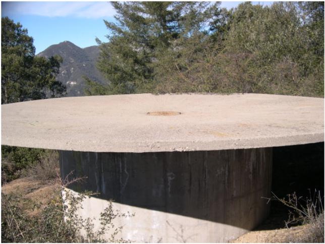 |
...it was either an alien launch pad or a cistern with a
dished collection plate on top with holes to allow the collected water to
get inside. I think it was made to look like that so we wouldn't suspect
it's real purpose (come on Fox and Scully, where are you when we need you?). |
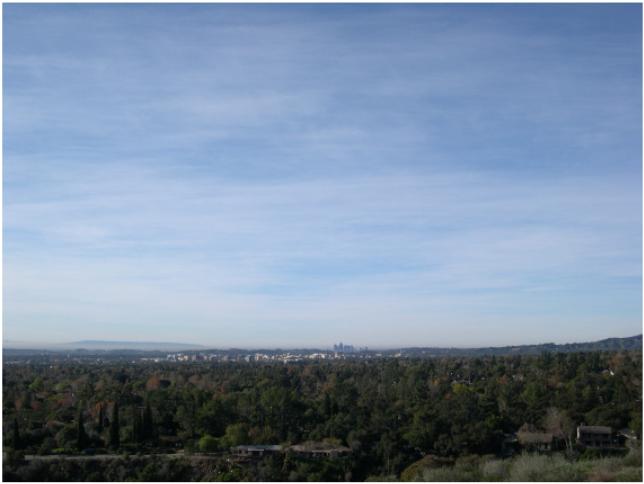
 |
Remember the picture we started with? You can tell that
we've come a long way. Look at Los Angeles still visible in the distance on
the right. |
 |
This is the Mount Probe that Andrey and I found. We're
convinced that the aliens take their captives here and probe them with these
uncomfortable looking articles. Ouch! |
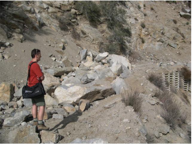 |
If you thought you could drive the Mount Wilson Toll Road
you would have been real disappointed at this point. Here, we've come about
8 miles into our 10.1 mile hike, and you can see the road is completely
blocked by these enormous boulders. |
 |
Incredibly luminous, the sky and horizon is taking on the
appearance of heaven. |
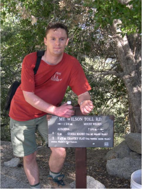 |
Andrey tries to wiggle out the sign post to take for a
souvenir, but they buried it too deeply. |
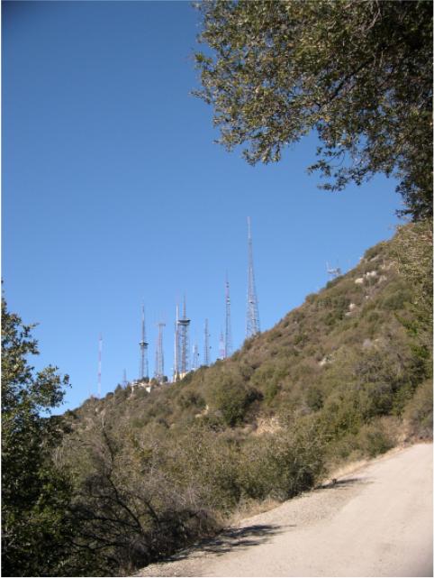 |
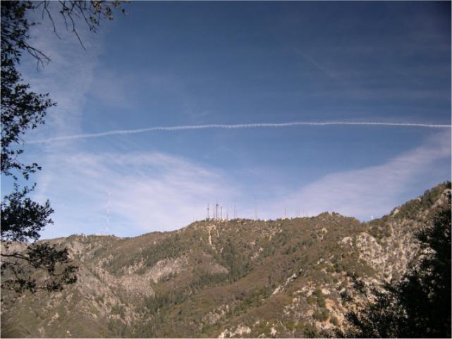
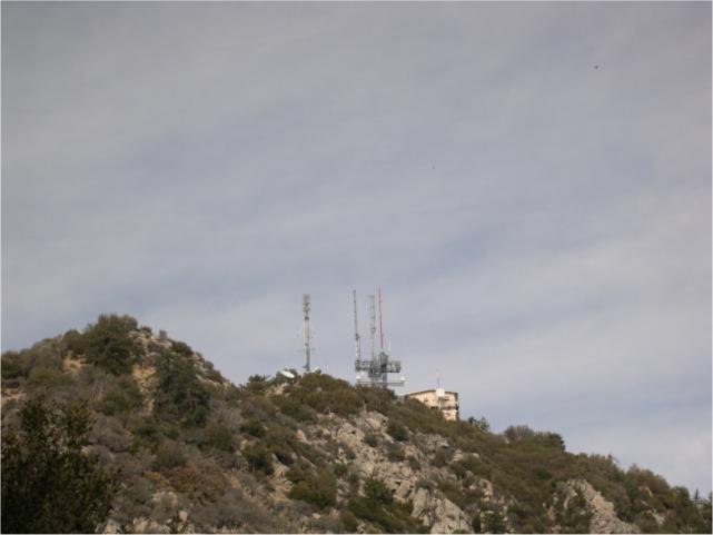
Ahhh, our goal is ever closer. This picture was taken just
as we merged into the final road that also goes from Mount Wilson to Mount
Probe (really Mount Harvard). For some more spectacular antenna shots taken
from an auto trip to the top several months earlier
<click here>. |
 |
Our final few feet come into view. At this point we had been
walking a constant uphill for 10 miles over 4 hours 30 minutes. Phew... sure
could use something refreshing... |
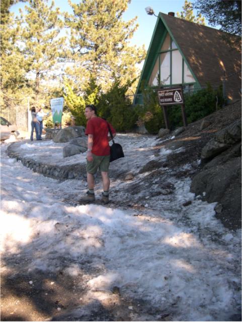 |
...whaaa, what's this?! Snow? You bet, there was snow at the
top as Andrey and I came to the forest facility up at the peak. You can see
Andrey's in a T-shirt, but the weather was nice enough to permit it. At
first I thought they had trucked this in for kids to play in from some point
elsewhere, but later as Elena was driving us home (she picked us up at the
top), we could see that the northern slopes at this elevation all had snow.
Some quite a bit. |
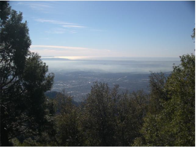 |
Here's the final view we enjoyed. You can see the southern
California sun playing off of the ocean in the distance. We could even see
Catalina. What a day! |